June 26, 2021
What Does a Land Surveyor Do?
Land surveying is an essential component of any construction or development project, but many people have a limited view of what it really entails and why it matters so much. Are you wondering what does a land surveyor do? Put simply — land surveyors are responsible for providing a property’s comprehensive, accurate parcel boundary and geospatial data.
Read on to learn more about land surveying and why it matters for the timeliness and quality of many different project types.
What Is a Land Surveyor?
A land surveyor is a highly trained professional who measures a plot of land to identify boundaries for design and construction purposes, settle property line disputes, or create maps. It takes years of training and education to perform multiple types of surveys. Many surveyors have degrees in surveying and mapping, civil engineering, or geomatics.
Because of the legal nature of surveying, a land surveyor’s work must be thorough and precise, and they must expertly use specialized equipment to determine boundary lines and existing conditions.
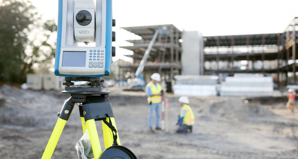
The Surveying Process
A land surveyor researches and gathers information about a property and uses it to perform the following tasks:
Measure
Once on-site, surveyors measure topographic distances, directions, and angles between points of interest, which are combined to create a topographic contour. Then, they use accurate reference points called benchmarks to determine the precise location of property features.
A body of water is an example of a property feature that requires detailed measurement. The crew identifies and documents any adjacent bodies of water and determines the water boundary of the subject property based on current and historical water levels.
Finally, a land surveyor considers previous property boundaries to discern the current legal boundaries of the subject property.
Research
Once the initial measurements are taken at a property, there is still due diligence to be done to create an accurate land survey.
If the survey is for a construction site, surveyors collaborate with other stakeholders to ensure that all project considerations are taken into account. Project stakeholders can include construction managers, land planners, civil engineers, or developers.
After which they verify data accuracy and register surveying results to create legal descriptions and survey maps.
Drawing
Once the land surveyor completes the necessary research and performs the survey using specialized equipment, they create a CAD-drawn, survey-grade map. This map combines all of the information and measurements they have gathered to be able to accurately describe the subject parcel for legal documentation purposes. This final drawing is the product they submit to clients.
When called upon, surveyors can even provide expert testimony in court regarding surveying matters and verify the validity of a land survey.
Trust Your Project’s Surveying Needs to the Experts at JBPro
When hiring a land surveyor, you need a specially trained professional, adept at using innovative equipment, technical expertise, and thorough research to interpret information that impacts the integrity of your project. From the simple to the complex of your residential, commercial, or construction project needs, ensure that your project gets started the right way by relying on the skilled team at JBPro. You can request a survey here from any of our surveyors in North Central Florida.